Simulating Urban Flows to Estimate the Disease Burden of Air Pollution
Nick Malleson
School of Geography, University of Leeds
nickmalleson.co.uk
surf.leeds.ac.uk
These slides: http://surf.leeds.ac.uk/presentations.html
Abstract
An understanding of how people move around cities is vital for building up reliable estimates of the population at risk for phenomena that vary in space and time. For example, to reliably assess the disease burden of air pollution on a population it is important to understand when and where the activities of individuals intersect with pollution hotspots. However, modelling dynamic populations is extremely difficult as most well-established data sources contain sparse information about non-residential activities. Fortunately, emerging data sources such as those arising through the use of social media or loyalty cards hold the promise of providing more reliable information about non-residential daily activities. The challenge, therefore, is to create a high-resolution model of urban flows that is able to take advantage of good quality residential and non-residential data sources.
This research proposes an original approach: to use agent-based modelling as the tool to bring together disparate data sources and create an accurate, high-resolution model of individual-level daily urban flows. The model will draw on advances from disciplines such as meteorology to dynamically calibrate the agent-based model as new data streams become available. Ultimately the results of the simulation will be married to estimates of pollutant concentrations to estimate the disease burden of some pollutants. Preliminary results illustrate that the model holds promise as a reliable tool for modelling the ambient urban population.
Outline
Context: The Ambient Population
Crime victimisation
Disease burden of pollution
Quantifying the ambient population
A new approach to merging urban flow data: Agent-Based Modelling?
Conclusions and outlook
Quantifying the Ambient population
Surprisingly poor data to quantify mobile populations
But understanding mobile populations is vital
Crime
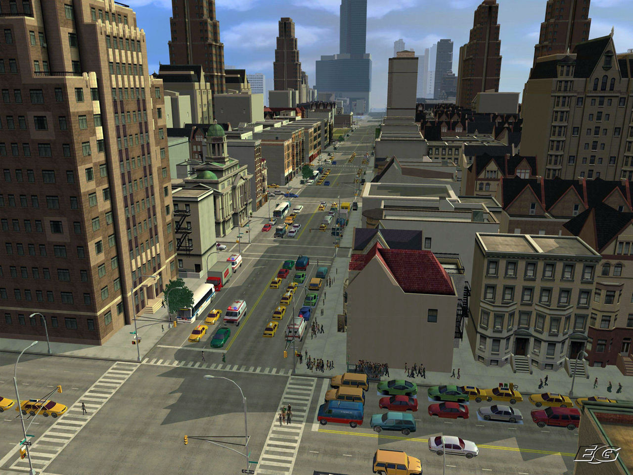
Daily flows of people radically alter urban characteristics
Substantial impact on crime rates (Andresen and Jenion, 2010; Felson and Boivin, 2015; Stults and Hasbrouck, 2015).
Pollution
Large variations over small scales (Britter and Hanna, 2003)
Human exposure also dependent on mobility
We need better models of the ambient population!
The 'Age of Big Data'

Explosion in data volume.
'Datafication' of hitherto private thoughts/actions.
Proliferation of GPS-enabled devices
Opportunity to better understand urban flows
The Ambient Population
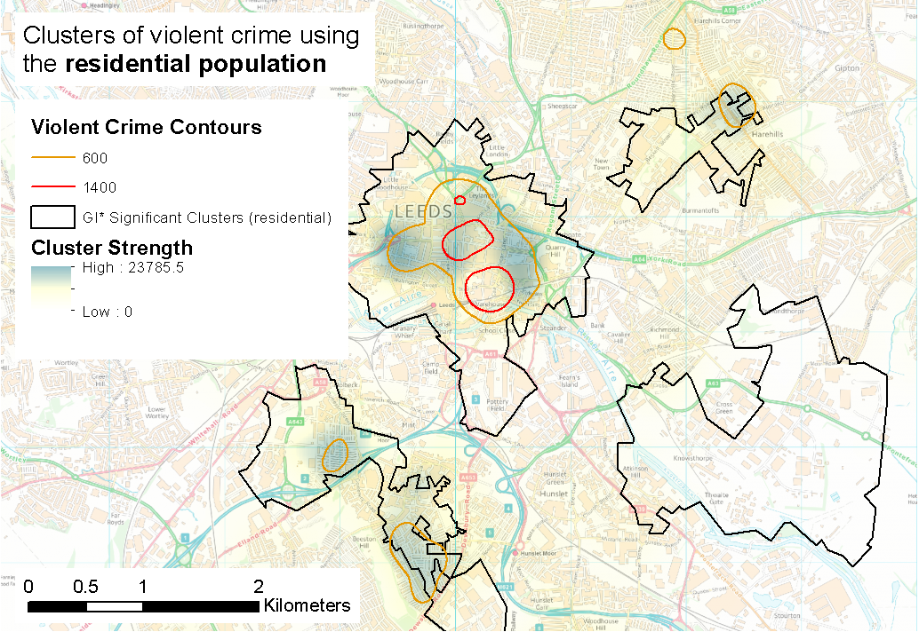
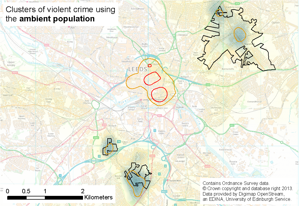
Crime Victims
What is the most appropriate denominator for crime rate calculations?
Residential population is the most common
But not always appropriate
Difficult to quantify hotspot severity without good population at risk estimates

Source: dreamingyakker (CC BY-NC-ND 2.0).
The Ambient Population
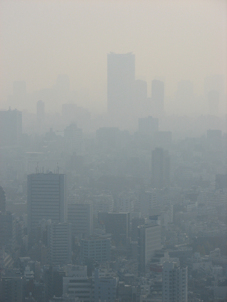
Impacts of Pollution
Largest cause of preventable deaths (WHO)
Improved models of pollution generation and dispersal
Including individual polluters (Nyhan et al., 2016)
But still relatively weak estimates of the population-at-risk
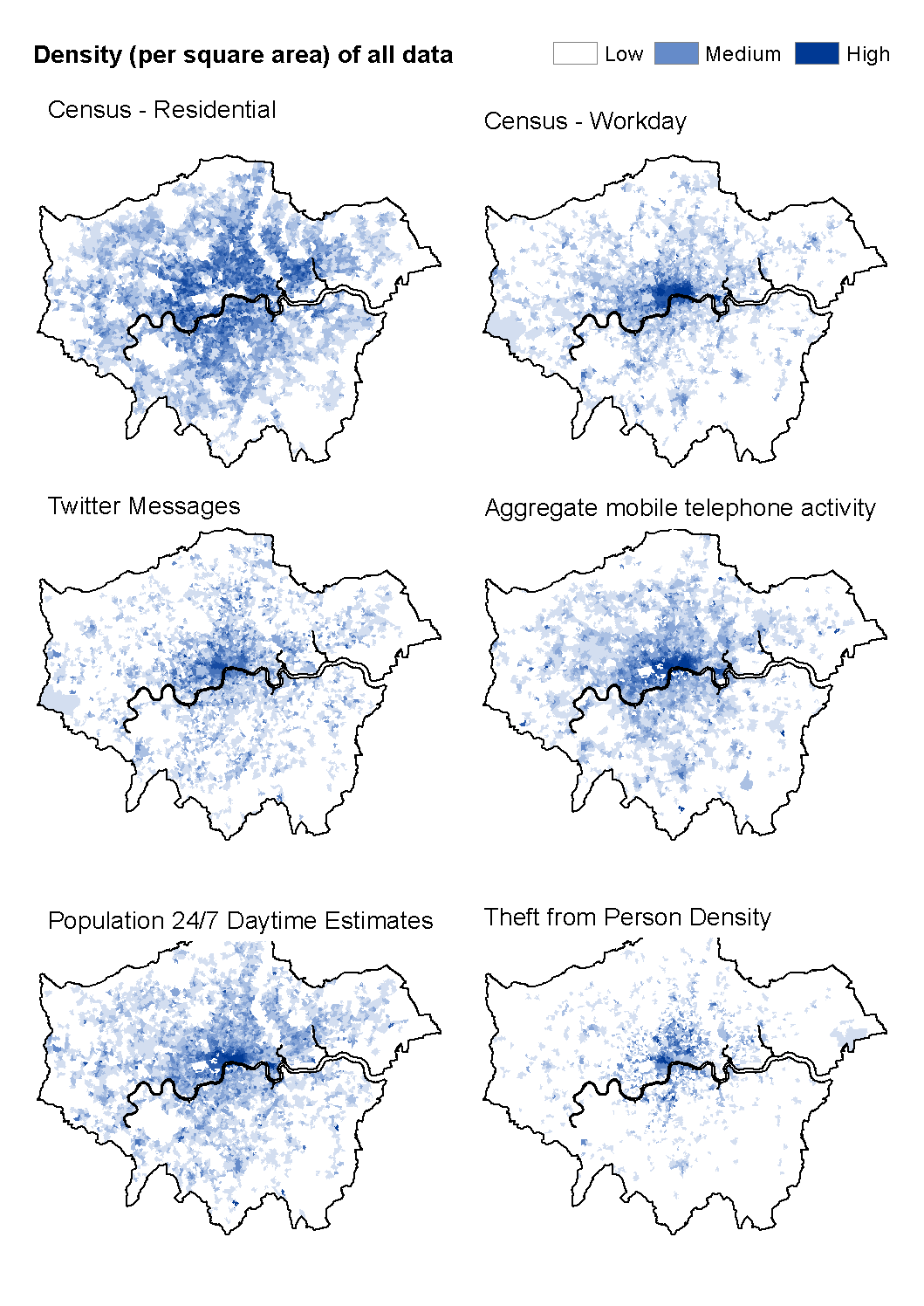
Individual Exposure
Related Work - Modelling dynamic /individual exposure
Travel diaries (& GPS tracking)
Calculate personal exposure (Yoo et al., 2015)
Travel surveys
Coupled activity model and dispersion model (Beckx et al., 2009, Dhondt et al, 2012, Setton et al., 2011)
Bulk mobile phone activity
. . .
Individual Exposure
Related Work - Modelling dynamic /individual exposure
Improved pollution models
Nyhan et al. (2016): large taxi data set to estimate street segment pollution (highly detailed: factored in acceleration!)
Consistent finding: Residential models underestimate exposure
Opportunity to use simulation to:
Combine data sources
Scale-up smaller surveys
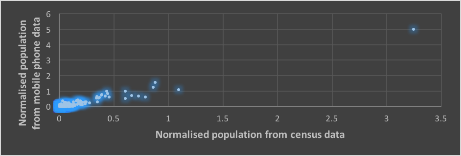
Urban Flow Data
The ambient population is important
But how to quantify it?
And how to better understand urban flows?
Urban Flow Data
Social Media
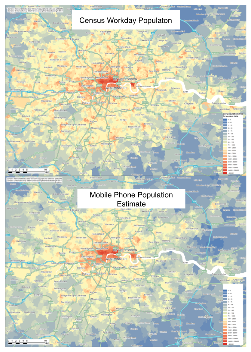
Urban Flow Data
Mobile Communications
Large population coverage
Private, unknown methodology, privacy concerns, coarse resolution (?)
Urban Flow Data
Geo-Apps
Smart-phone apps that capture movement / location are becoming ubiquitous
Great potential for understanding (some) urban dynamics
Urban Flow Data
Difficulties
Skewness
Prolific users distort patterns
Representation
Online & public ≠ offline & private
Spatial accuracy
Bias
Participation inequality and the digital divide
Complicated!!
Messy, and "too big for Excel"
Benefits
Volume
Potential for large sub-samples
Velocity
Streaming / regularly updated
Potential for dynamic models
Need to consolidate diverse sources
Solution: Agent-Based Modelling ?
Agent-Based Modelling (ABM)
Autonomous, interacting 'agents'
Model phenomena from the 'bottom-up'
Advantages:
Modelling complexity, non-linearity, emergence
Natural description of a system
Bridge between verbal theories and mathematical models
History of the evolution of the system
surf
Big Data, ABM, Smart Cities, Ambient Populations
A city-wide dynamic ABM, constantly re-calibrated to streaming data
New insights into urban mobility patterns and footfall estimates.
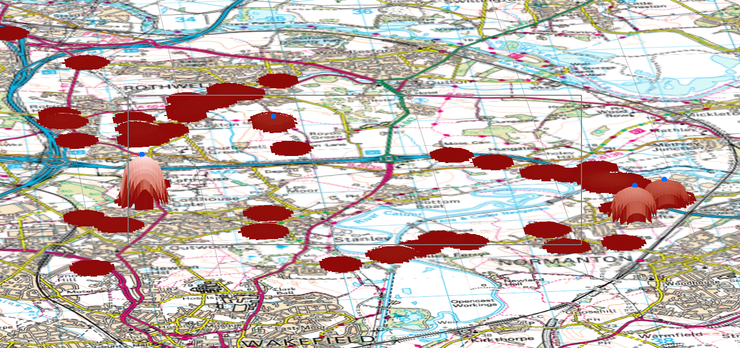
Simulating Urban Flows (surf) prototype

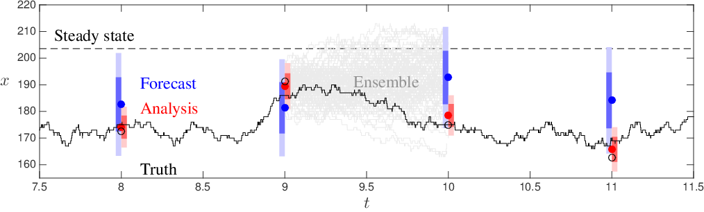
Dynamic Data Assimilation
Approach
Used in meteorology and hydrology to constrain models closer to reality.
We can:
Restart model with new (up to date) data
Adjust model parameters to better match reality
How?
Particle filters
Kalman Filter
Ensemble Kalman Filter
Sequential Monte Carlo (SMC)
... others ...
Ensemble Kalman Filter (EnKF)
Outline
Conclusion and Outlook
Ongoing advances in pollution modelling
Models of the population need to keep pace
Opportunities with 'big' data
(Agent-Based) simulation as a means of:
Combining disparate data
Scale up small surveys
References
Andresen, M. A., and Jenion, G. W. (2010). Ambient populations and the calculation of crime rates and risk. Security Journal, 23, 114–133.
Beckx, C., L. Int Panis, T. Arentze, D. Janssens, R. Torfs, S. Broekx, and G. Wets (2009). A dynamic activity-based population modelling approach to evaluate exposure to air pollution: Methods and appli- cation to a Dutch urban area. Environmental Impact Assessment Review 29(3), 179–185.
Felson, M., and Newton, A. (2015). Crime patterns in time and space: The dynamics of crime opportunities in Urban areas. Special issue. Crime Science, 4.
Nyhan, M., Sobolevsky, S., Kang, C., Robinson, P., Corti, A., Szell, M., Streets, D., Lu, Z., Britter, R., Barrett, S.R.H., Ratti, C., (2016). Predicting vehicular emissions in high spatial resolution using pervasively measured transportation data and microscopic emissions model. Atmospheric Environment -. doi:http://dx.doi.org/10.1016/j.atmosenv.2016.06.018
Setton, E., J. D. Marshall, M. Brauer, K. R. Lundquist, P. Hystad, P. Keller, and D. Cloutier-Fisher (2011). The impact of daily mobility on exposure to tra ic-related air pollution and health e ect estimates. Journal of Exposure Science and Environmental Epidemiology 21(1), 42–48.
Stults, B. J., and Hasbrouck, M. (2015). The effect of commuting on city-level crime rates. Journal of Quantitative Criminology, 31, 331–350.
Ward, J., A. Evans, N. Malleson (2016) Dynamic calibration of agent-based models using data assimilation. Royal Society Open Science. 3:150703. (open access)
Yoo, E.-H., Rudra, C., Glasgow, M., Mu, L., 2015. Geospatial Estimation of Individual Exposure to Air Pollutants: Moving From Static Monitoring to Activity-Based Dynamic Exposure Assessment. Annals of the Association of American Geographers.
Thanks
Simulating Urban Flows to Estimate the Disease Burden of Air Pollution
Nick Malleson
School of Geography, University of Leeds
nickmalleson.co.uk
surf.leeds.ac.uk
These slides: http://surf.leeds.ac.uk/presentations.html